

Seuraat nyt käyttäjää
Virhe seurattaessa käyttäjää.
Tämä käyttäjä ei salli käyttäjien seurata häntä.
Seuraat jo tätä käyttäjää.
Jäsenyystasosi mahdollistaa vain 0 seurausta. Päivitä tästä.
Käyttäjän seuraaminen lopetettu onnistuneesti
Virhe poistettaessa käyttäjän seurantaa.
Olet onnistuneesti suositellut käyttäjää
Virhe suositeltaessa käyttäjää.
Jokin meni vikaan. Päivitä sivu ja yritä uudelleen.
Sähköposti vahvistettu onnistuneesti.

lahore,
pakistan
Aika on tällä hetkellä 12:44 ap. täällä
Liittynyt heinäkuuta 13, 2017
0 Recommendations
Muneeb A.
@MUNEEBAAMIR
0,0
0,0
0%
0%
lahore,
pakistan
Ei saatavilla
Suoritetut työt
Ei saatavilla
Budjetin mukaisesti
Ei saatavilla
Aikataulussa
Ei saatavilla
Uudelleenpalkkausaste
Geospatial Expert
Ota yhteyttä käyttäjään Muneeb A. työhösi liittyen
Kirjaudu sisään keskustellaksesi yksityiskohdista chatissa.
Portfolio
Portfolio


Preparation of Digital Elevation Model
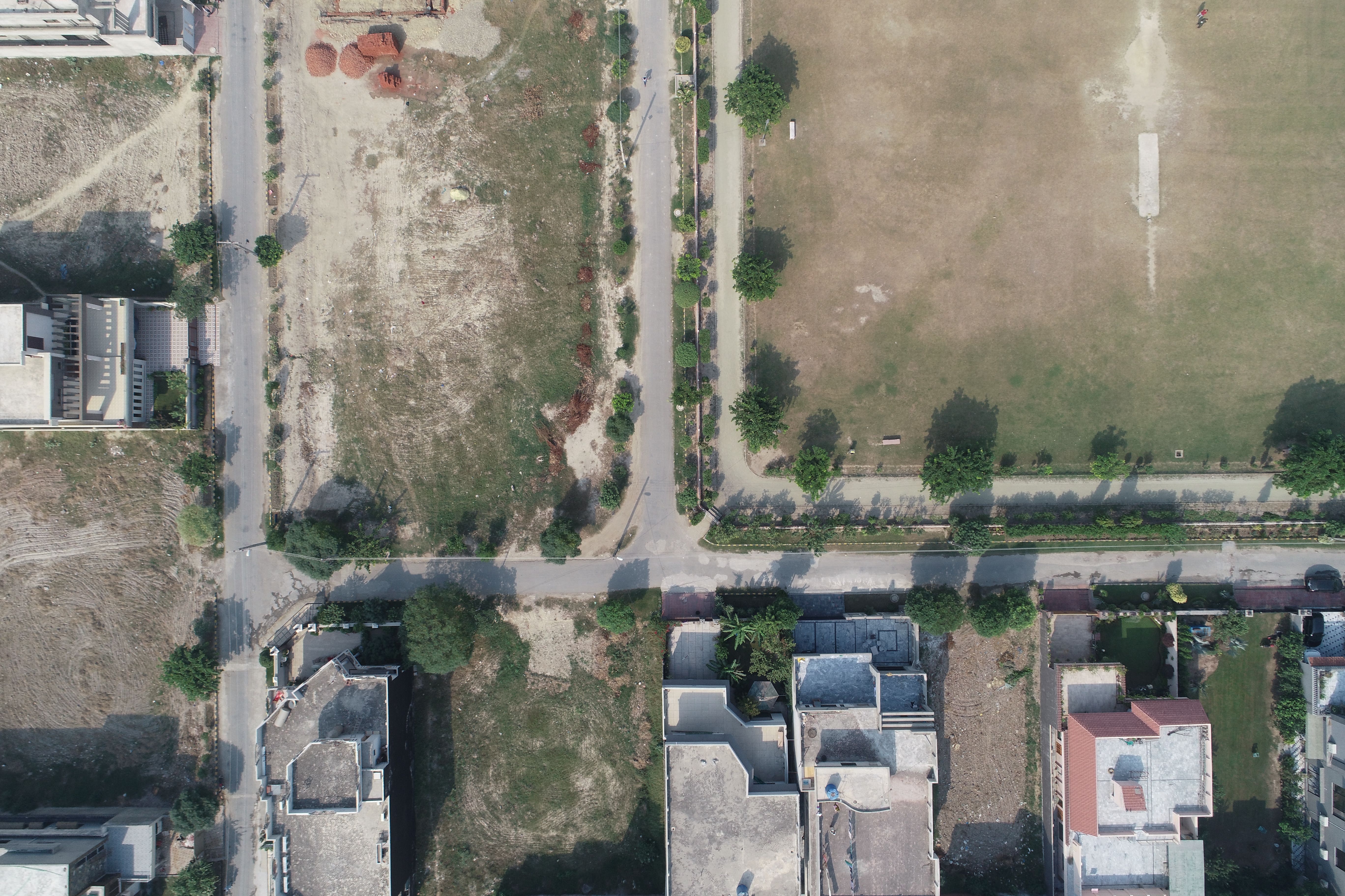

Drone Mapping

Drone Mapping

Drone Mapping
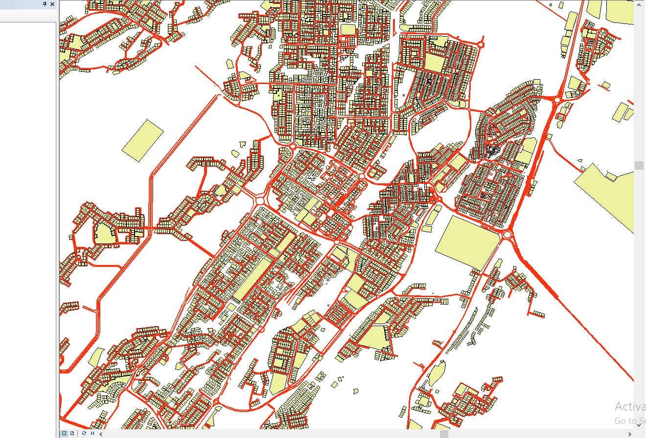

CAD to SHP Files

CAD to SHP Files
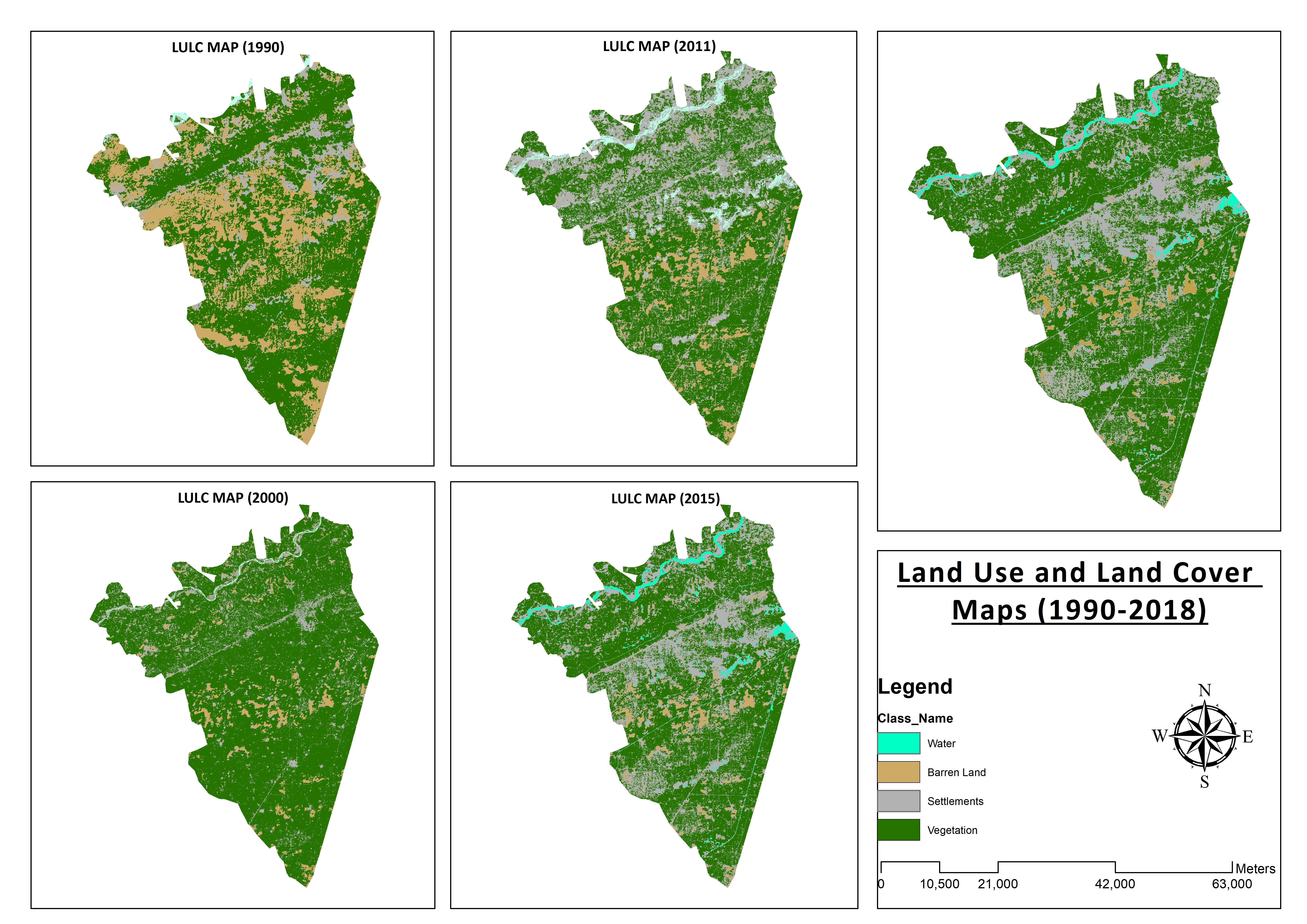

Land Use and Land Cover Maps
Preparation of Digital Elevation Model
Drone Mapping
Drone Mapping
Drone Mapping
CAD to SHP Files
CAD to SHP Files
Land Use and Land Cover Maps
Arvostelut
Muutokset tallennettu
Ei arvosteluita!
Kokemus
Remote Sensing and GIS Analyst
syysk. 2018 - lokak. 2019 (1 , 1 )
Developed, integrated and Implemented GIS and Geodesy based Topographic Survey Plans under different Hydro-Power Projects in Northern Pakistan, Extension of Canal Projects to increase its capacity in Sindh-Balochistan, Analysis of Suitable Site Selection for different development sites by using Drone for Aerial Mapping and their detailed pre-feasibility studies with different softwares, to analyse and interpret spatial data to produce interacting Maps and Reports while ensuring quality control.
Research Associate GIS
lokak. 2015 - lokak. 2018 (3 vuotta)
Deployed GIS-based system under Urban Immovable Property Tax (UIPT) for Punjab Excise & Taxation Department. Provided comprehensive support in creating the system while take advantage of software suites like ArcGIS Suite and ERDAS Imagine. Prepared communicating maps to help surveyors in Analyzing geo-spatial data to verify it during ground truthing. Created shapefiles to merge topographical data with external data through layering process.
Koulutus
Master of Philosophy in Geographic Information System
(2 vuotta)
Bachelors in Geographic Information System
(4 vuotta)
Pätevyydet
MS-Office
TEVTA
2017
MS-Office Certification in MS-Word, Excel and Power Point.
Julkaisut
Analysis of Flood Damage Assessment through Different Satellite Datasets in Southern Punjab,Pakistan
International Journal of Innovations in Science & Technology
RS and GIS techniques can achieve the objectives and significant analyses through visual interpretations. These techniques are also used to identify the flood affected regions. The study site was examined by applying supervised classification determining that 16900.96 Hectors of agriculture land was damaged while Sparse Riverine Forest had the area 44.52 hectors. The damaged built-up area was 1805.78 Hectors.
Estimation of Net Rice Production by Remote Sensing and Multi Source Datasets
Sarhad Journal Of Agriculture
Estimation of net crop production before harvest enables agronomists and decision makers to determine the volume of grain precisely. Yield estimation is one of the challenging tasks which is significant to evaluate accurately for farmers. This research was conducted in eastern Punjab Pakistan by incorporating yield/area as reported by Crop Reporting Service Department along with open source satellite datasets.
Ota yhteyttä käyttäjään Muneeb A. työhösi liittyen
Kirjaudu sisään keskustellaksesi yksityiskohdista chatissa.
Varmennukset
Parhaat taidot
Selaa vastaavia freelancereita
Selaa vastaavia näyteikkunoita
Kutsu lähetetty onnistuneesti!
Kiitos! Olemme lähettäneet sinulle sähköpostitse linkin, jolla voit lunastaa ilmaisen krediittisi.
Jotain meni pieleen lähetettäessä sähköpostiasi. Yritä uudelleen.
Kopiointi leikepöydälle epäonnistui. Yritä uudelleen, kun olet muuttanut käyttöoikeuksiasi.
Kopioitu leikepöydälle.
Ladataan esikatselua
Lupa myönnetty Geolocation.
Kirjautumisistuntosi on vanhentunut ja sinut on kirjattu ulos. Kirjaudu uudelleen sisään.